Floating, Dragging, Cooking, Camping
On the first day, we did a lot less “floating” than I expected and a lot more “dragging a loaded kayak over rocks barely submerged in two inches of water” than Dave mentioned when he did the research. We’d pull the boats for 50 feet, hit some deeper water, jump in, ride about 20 feet until our boats got caught on a rock, get out and pull the boats another 50 feet.
We also encountered the only other people we would see during the entire nine days on the river—three people and their wet dog, who had convinced them that he should come along. Two women sat in an overloaded raft and the man and dog hunkered in an equally low-riding freighter canoe. They lugged the boats through water we glided over. We stopped to help them dislodge the freighter from a rock. We’d been alternately floating and dragging boats for four hours. They had been doing the same, covering the same distance, for three days. Another bonus point for the IKs.

Once you pass the shallow water, Birch Creek is primarily Class I, with an uncountable number of riffles to make it fun. A couple of Class II sections seem straight-forward, except perhaps that one with the 90-degree turn at the bottom of it. I didn’t dump the boat, and most other people won’t either. Shotgun Rapids is listed at anything between Class II+ and Class III+, depending on water levels. It is the only technical part of the river between Mile 94 and Mile 140.5 of the Steese, and you can walk around it if you decide not to run it. More on that little misadventure later.
Mostly that first day, and for the entire foray, we relaxed and watched the scenery. Birch Creek’s bedrock is creatively named “Birch Creek Schist.” It is some of the oldest rock in Alaska, formed by high temperatures and pressure, which in time makes, I don’t know, science happen, and then the rock is there. Exposed rock faces line the river banks, rising a hundred feet above the water’s surface. Birch Creek’s gravel bars are a rock hound’s paradise, littered with quartz, garnet and muscovite-streaked pebbles. Cutbanks offer a view of what permafrost, normally hidden under layers of insulating dirt, rocks and ice, looks like. Ice lenses form where the sun melts the permafrost, forming slight indentations in the mud. The bowl shape of these divots directs more light toward the center, and the melting lenses deepen. The surrounding forest consists mostly of stunted black spruce, rising out of the land like big black pipe cleaners. This latitude is hard on anything that is trying to grow. Earlier in the summer, bright pink fireweed lined the banks and the mountainsides, but by August, the flowers had gone to seed. The tall river grasses rustled in the breeze and appeared to glow gold in the low autumn sun.
We started our days with a completely improbable breakfast considering how far we were from home. Dave pulled cinnamon rolls, bagels, sausages and eggs out of that cooler. It was a good thing I was in charge of dinners because I had no idea that people ate anything other than a handful of raisins for breakfast in the backcountry.
Dave was polite enough about my dinner offerings, although he did mention, every night, that his wife brings a Dutch oven on float trips so she can make a hot cobbler using the berries she forages during the day. I decided not to offer my dessert of raisins and M&Ms and pretended I’d forgotten my crepe pan.
After dinner, we floated another mile so we weren’t sleeping near where we had cooked. I spotted hundreds of places to camp in a five-minute span, but Dave nixed them all. Maybe it’s a guy thing, this need to find the perfect campsite. After a long day of paddling or hiking, I’m only interested in a semi-dry spot that, ideally, is at least a little wider than I am. All of the men I have traveled with seek out campsites as though we are going to start our lives anew on that spot. Dave was no exception. I have never slept so comfortably on a pile of rocks in my life than I did when he finally picked the perfect location.
Camping in Alaska has challenges you don’t find in other places. I call those challenges “bears.” When canoeing in Vermont, at the end of the day you pull your boats out of the water, grab a cooler and chair and sit next to your tent to have dinner. In Alaska, setting up camp takes a lot more time. You have to unload everything from your boat so Mister Bear can see that there is nothing to dig through. The bear might dig around anyway, but you can try. Anything that smells like food, has ever contained food or was in the vicinity when someone was talking about food must be hung from a tree in a way that no bear can reach it. The tree must have a branch at least 20 feet from the ground that extends at least 15 feet away from the trunk of the tree, and has no other branches near it. There must not be another tree nearby that the bear could climb to get to the food in your tree. The branches on the tree must be strong enough to support the load of your cache of food, but not strong enough to support the weight of a bear. There are no such trees in Alaska. Once you figure that out, you can cache your food in a pile at least 100 feet from your tent, 100 feet from where you cooked (which is at least 100 feet from your tent) and another 100 feet from your boat. Dave likes to cover it all with a tarp and then put pots and pans on top of it all so we can listen to the bear ripping our stuff apart.
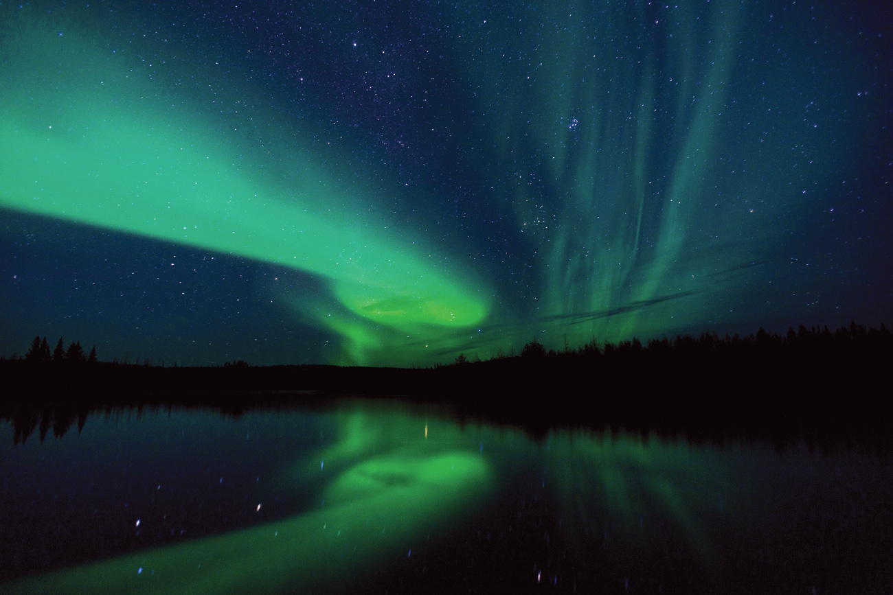
The dark fall sky in Alaska almost guarantees northern lights, but I’m not really a “vivid greens and purples dancing across the starry sky” kind of writer. Yep, we saw them. Yep, they were cool. We saw caribou swimming, too. Not at the same time as we saw the lights.
I generally took the lead with our two boats, mostly because I hadn’t figured out this whole “float trip” thing and insisted on paddling. Dave was much better at floating than I was. The first time we saw a herd of caribou I scared them off by yelling, “Hey Dave, look at the caribou!” Not a good way to show Dave the front half of an animal. After that we worked out a system—I’d raise my paddle above my head to signal Dave to look onshore. Much less alarming to a caribou, I must admit, and they’d watch us drift past. A few would jump up from their resting position, ready to bolt the moment we crossed an invisible line they’d drawn in the gravel that we never crossed.

Navigating the Rapids
After about six days on the river, I found myself staring at Shotgun Rapids (Class III) right about the time we decided they must be a few more miles downriver. If you run this stretch of water, make sure you approach these rapids from river left. There is a huge gravel bank you can pull onto so you can scout out your line after beaching your boat. You can easily travel on foot up and down the river and get a really good look at what you are about to do. I didn’t do that. I approached from river right (the right side of the river as you face downstream) and saw and heard the rapids at the same time. There is a really friendly looking eddy at the top of the first drop-off at river right, and I paddled like a mad beaverschnitzel to get there. From there I signaled Dave to head to river left and pull up there. We spent the next half hour yelling and waving at each other from opposite sides of the river. We couldn’t hear each other over the rushing water but that didn’t stop either of us. Yelling. Waving. Pointing. Holding a hand up to an ear and mouthing “What?” It’s not a form of communication I recommend. He finally lined his boat upriver to give himself time to paddle across to where I was stranded, beached his boat and walked up to me and yelled, “What?” He thought that was funny. Now that we were both on the wrong side of the river, we portaged our gear and boats down over the first drop. We repacked the boats and put them in the water right below and ran what turned into our favorite run of the whole river. Experts talk about how to negotiate rapids and the necessary scouting, which makes approaching whitewater sound so intimidating. Then you run it and the adrenaline takes over. Every stroke of the paddle, every brace, every backstroke to buy yourself a second so you can correct your line feels intuitive, and when you’re spit out the bottom of the run, your first thought is  I want to do that again. Thirty seconds earlier, before you got on the water, all you wanted was for this to be over. After the excitement of Shotgun, the river turns back into a quiet, pleasant float for a few more days.
Finding the take-out at Milepost 140.5 is easier with the help of a GPS. Not that we used one, but you should. Mark the location ahead of time, set that alarm and listen for it. We cruised the river left bank looking for the parking lot until the people with the freighter caught up and told us they’d placed a bright orange flag on the bank at the take-out. As we floated toward the end of our adventure, we asked how they’d managed the rapids. We’d envisioned them having to make a bunch of trips down the rocks with their gear, then two more hauling those heavy boats over the rocks. It didn’t happen that way. They’d approached from the correct side of the river, scouted their routes and ran the line straight down the center of the rapids. It was so fun that they unloaded their boats at the bottom of the rapids and portaged their boats back up the rocks to run it two more times. I felt like a total piker for screwing that up.
The people with the freighter had parked a car at the pull-out, and Dave talked them into a ride back to ours in exchange for our help in schlepping their gear up from the river bank to the parking lot. They wanted to hike up Eagle Summit on the way back to where our car sat, so I had no idea when Dave would return. As he drove off with them, I walked back to the river’s edge under gray skies to start hauling our pile to higher ground, swatting at mosquitoes and feeling the first drops of rain.